![]()
Page 12f
Our trip to Roy, Utah
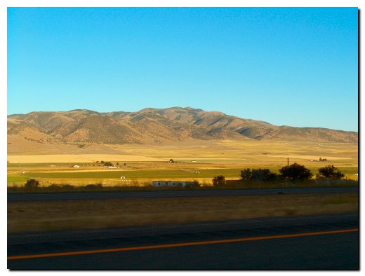
We departed Roy, Utah this morning by 6:30 AM and missed our estimate on driving time. Luckily we over estimated the time so our trip to West Yellowstone, Montana took considerably less time and we arrived at our motel before noon. But I am getting ahead of myself; it took us about an hour and a half to leave Utah by driving north on I-15. The picture below was taken at the first rest stop in Idaho and as you can see the terrain changed quickly along this route.
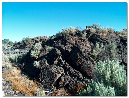
As we traveled through Idaho we started to notice in the change in the rocks, instead of red or whitish gray the stones turned almost black. Our next stop featured a half-acre of volcanic rock that was the result of molten lava oozing through cracks in the ground and solidifying on the surface. The sign at this stop told us that this lava flow occurred a few thousand years ago and the 30 to 50 run of these formations have not yet been covered with soil since they are so new. The picture below is a small portion of the rocks we saw at this stop.
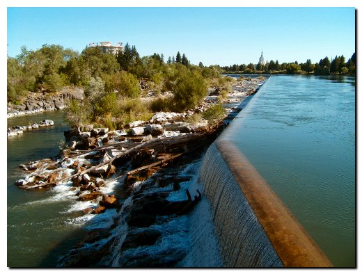
Our first real break of the day was a stop at Idaho Falls. We found this to be a very pretty town with the Snake River running through the downtown section. The picture below shows the dam and falls on the upstream side of the bridge. This is part of a hydroelectric project and the entire area is very well landscaped.
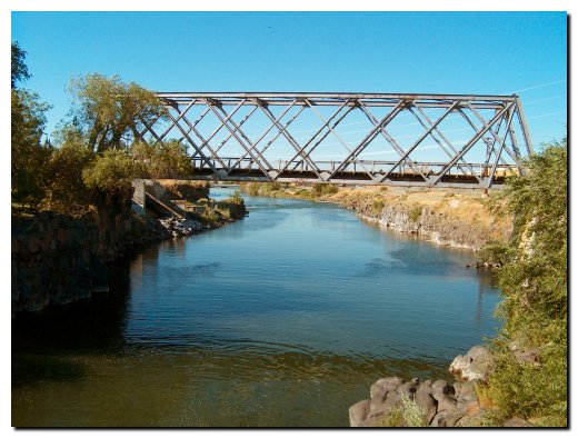
The downstream side of the river, in contract, is very placid and crossed by an old steel bridge. The black lava rocks on this side of the dam have been smoothed by years of water flowing over them.
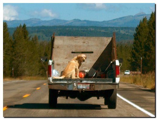
When we were just outside of West Yellowstone, Montana a big yellow dog riding in the back of this truck entertained us. He seemed to want to see out the front and would peek through the hole in the wood truck box, then walk to the back of the truck and try to crane his neck around the side. Several times we thought he might jump out.
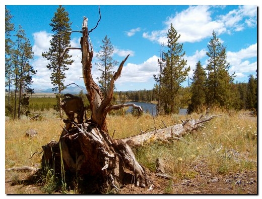
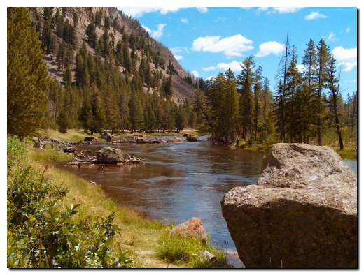
As I mentioned when I opened this page, we arrived to West Yellowstone by noon and after checking into the motel and having lunch we drove to Yellowstone Park by way of the west entrance. Our original plan was to drive through the park tomorrow, but we made use of this afternoon by driving around the park seeing things we missed on our last trip. The picture below is the first I took in the park and is of the Madison River. Today’s drive through the park seemed to center on breathtaking water scenes and wildlife.
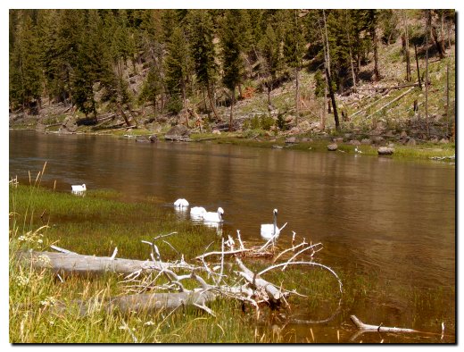
We rounded a corner to find a line-up of cars pulled off the road so we did the same, expecting that there must be some wildlife to observe. We found that 5 Trumpeter Swans were quietly harvesting plant life off the bottom of this river while tourists furiously jockeyed for position on the bank to shoot their pictures.
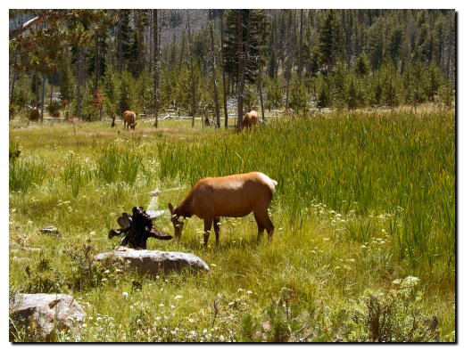
Our next stop was another cluster of cars pulled off to observe these doe elk as they grazed near the road. The traffic was pretty heavy so Sandy took a couple pictures out the window and I made sure I didn’t or wasn’t hit by another vehicle. We were told by a park official that the buck elks are off by themselves and the doe and young have herded up awaiting their mating season in September. The buck elk are off on their own although we did see one later in the afternoon.
I tried to take a picture of a hawk or falcon that I heard at this river site, but he was too fast and high for me. So I settled for this river scene.
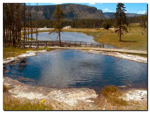
We visited several thermal geysers along the way, this one is called Terrace Springs. There is one basin above this one but this picture shows the small heated pond below better.
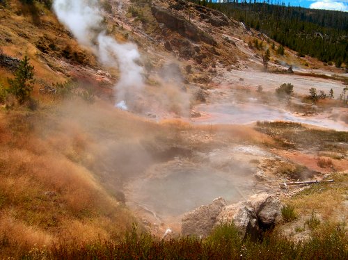
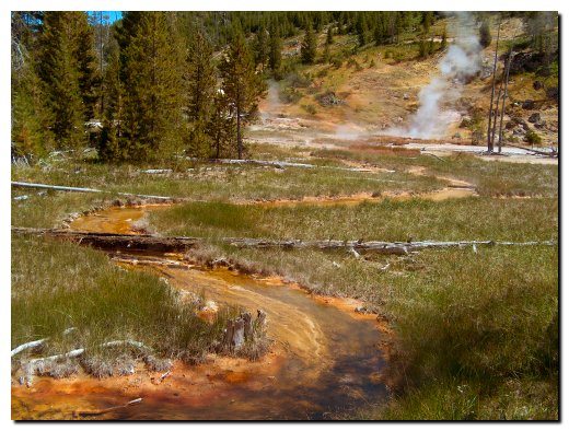
We felt a little deceived at this thermal area. The park service plainly marked it as the Artists Paint Pot, but failed to tell us that it was almost a mile from the parking area. Normally we would not mind this sort of a hike, but the day was wearing on and we wished we had skipped this area based on the time it took. The picture above shows the geyser activity and the picture below shows the rivulet of water running out of this area, rich with colors from the minerals and bacteria carried by the water.
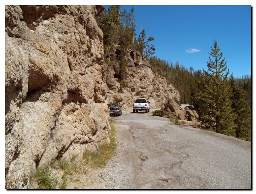
There are many small scenic drives along the main road, the picture below was the result of a failed attempt to take a picture of the Virginia Cascade. We did see the cascade, which was water flowing over dark rocks, but since the traffic on this cliff-side road was horrible and I did not want to teeter over the edge of the cliff I shot this picture of the car parked on the safe side of this road as I tried to get a picture.
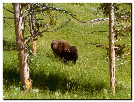
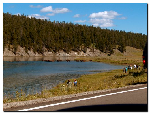
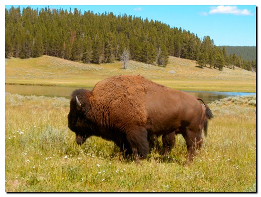
The next three pictures are of the bison we saw along the road. The first was grazing below us and I walked as near as I felt was safe, others went much nearer but I played it safe. Then we saw a heard crossing a river. The final picture was taken from the car as I stopped briefly; I was not getting out to take this picture. The park official that filled us in on the elk also told us that the bison are in the middle of their mating season and have both male and female in the same herd. His advice of course was to give them a wide berth.
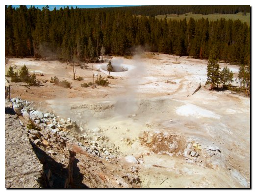
This area of very smelly thermal activity reminded us of concrete if one could put it in a pot and boil it. The sulfur smell was horrible, but a couple bison bulls were lounging just a few feet away form this area.
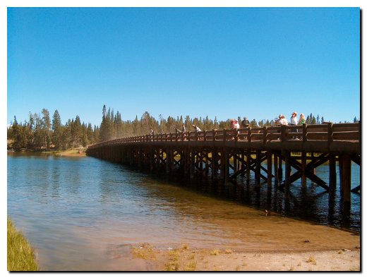
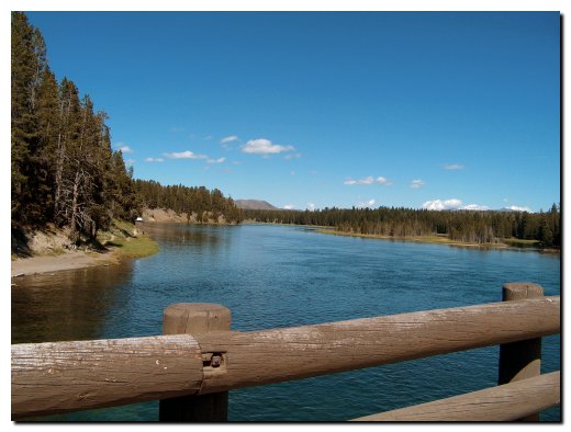
The next three pictures feature the fishing bridge, as it is known in the park. The first bridge of this sort was built in 1902 and replaced with this one in 1937. Fishing was stopped in 1973 because of the heavy pressure it placed on the Cutthroat Trout that make this their spawning grounds. But it is still a very popular area to view the fish swimming in the crystal clear water. The second picture is the river side of the bridge and the third shows the river as it meets the lake.
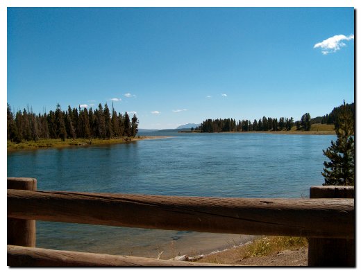
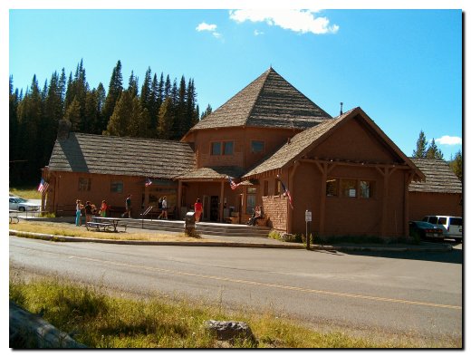
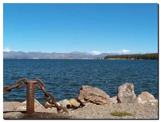
We had a late afternoon break at the Lake Village General store; the ice cream was great. We enjoyed it on a picnic table in the sun, the temperature was in the upper 60’s and the sun felt great as we looked across the road at the scene in the second picture.
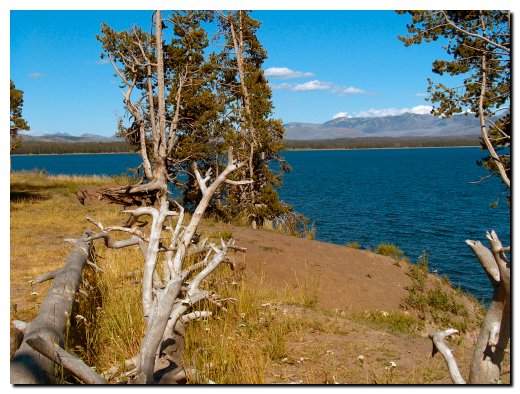
Our final Yellowstone Lake picture was taken at lake level at what is called the West Thumb. This is actually a large bay on the southwest side of the lake and when viewing the map it looks a little like a thumb on a hand.
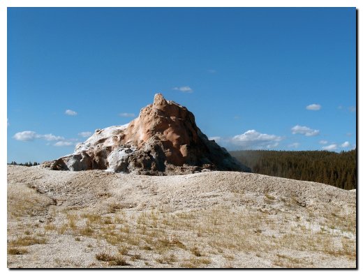
Our final picture for this page is of the White Dome Geyser. It had erupted earlier as the boardwalk surrounding it was still wet. This dome continues to grow as the silica-laden water erupted and flows down the sides. We left the park following this drive and headed back to the motel for dinner and a good night’s sleep.
Tomorrow we depart for Deadwood, South Dakota.