|
|
Page 26e |
|
Our Big Trip Across the Western US - September 2015
Our Saturday travel day began about 7:20 AM as we left Hurst Texas. We had good luck getting on the correct roads first time and whizzed right out of the metropolitan area without incident. As we headed towards the northwest to Wichita Falls Sandy studied the travel books and we planned several small side trips to break up the long run on US-287 and I-40. Our first stop was Childress Texas where we looked for a 1935 Spanish style post office that is now a museum. It was probably fortunate that they were closed today as we really didn’t have the time to browse through a museum. 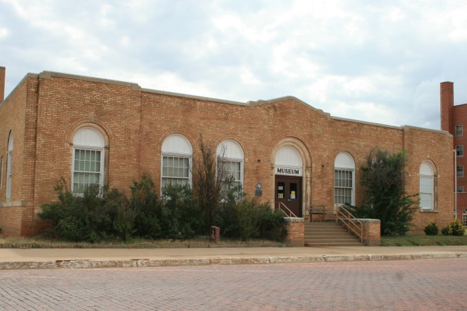
Our next stop was Memphis Texas to see an old Presbyterian church with a large dome roof. It is said to be styled after the St. Peter’s Basilica in Rome. The windows are all European stain glass and has an organ that is one of two left in the US. We don’t believe the church is currently in use but is in remarkable condition. 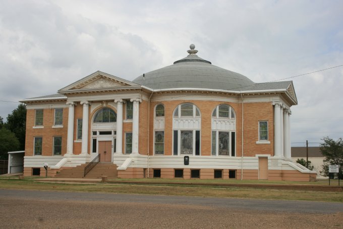
We left US-287 at Memphis and took Texas 256 to see the Cap Rock area. The terrain started out as a high flat plain and quickly turned into a rugged red rock canyon. We pulled off a couple places to get a better look at the area, including this dirt road. 
This highway took us to Silverton and then near the town of Canyon and it was there that we drove to the Pala Duro Canyon State Park. There was a $5.00 per person entry fee and it was worth every penny as we drove the 16 miles of black top roads. The canyon, also known as the Grand Canyon of Texas, is the 2nd largest canyons in the United States. 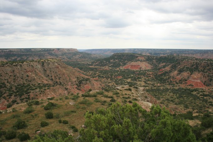
The rock formations were interesting and varied. There is a lot of vegetation on the cliffs adding to the contrast to the dark red rocks. This interesting rock formation is called the Light House. 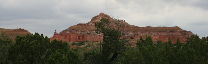
This next picture is a closer view of the Light House. This rock structure is visible from several turnouts and there is a trail to hike to it. There are warnings about the high heat, need to stay hydrated, and not to try it unless you are very fit. We didn’t take the hike (we didn’t have a minimum of one gallon of water each to carry with us). 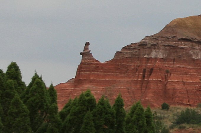
The next picture shows the size of the cliff walls. Look very closely and you will see people hiking to the large hole in the cliff wall known as Fortress Cliff. (red arrows mark the people) 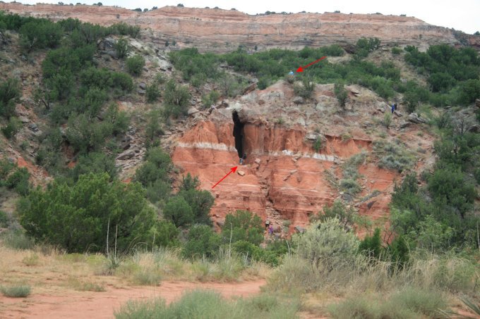
Following the state park we drove to I-40 at Amarillo and headed west. Part of the streets we drove on was part of the old Route 66 that connected Chicago to Santa Monica. Today the route has been taken over with interstate highways but portions do still exist. We got off I-40 to see Magnolia Station at Vega Texas. This is a restored old Route 66 gas station that really does look every bit of the old days. We read a sign that indicated that Magnolia brand oil later became part of the Mobil Oil name. 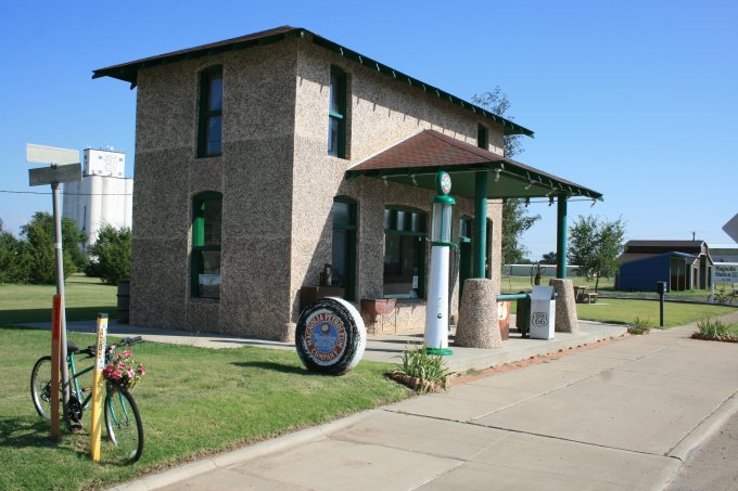
Our final stop was at the mid-point on Route 66. This point is marked on the old Route 66 (not the interstate) at Adrian Texas. There is a café across the street from this marker and is the oldest continuously operating café on Route 66. 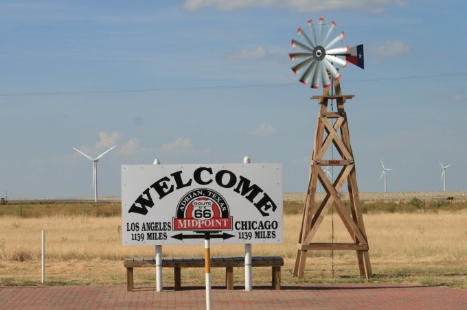
If you do not see a menu on the left click here to go to our home page. |