|
|
Page 26g |
|
Our Big Trip Across the Western US - September 2015
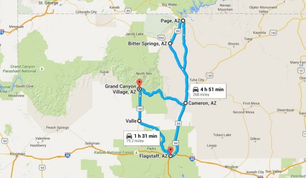
We retitled this page so we could separate the Grand Canyon visit from the Horseshoe Bend visit even though both occurred on the same day. We took so many pictures of each that to do both justice we have two pages for Monday September 14th. We started our day trip about 7:30 AM instead of the 8:00 AM we had planned and were pleased we did. It was threatening rain and we thought we could outrun the showers. Our trip out of Flagstaff was very convenient and we followed US 89 north. Our first stop was a scenic overlook that gave us a view of the North Rim of the canyon and the highway taking visitors to that side of the canyon. 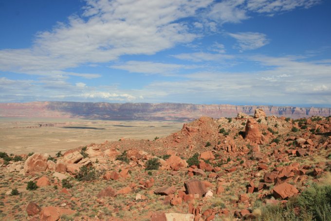
We managed to miss the road running straight north to Page so ended up at Horseshoe Bend parking area first. The parking lot was nearly full as we grabbed our camera gear and headed out on the ľ mile trail to the bend. This picture was taken from the top of the hill that rose about 50 feet above the parking lot. The red arrow points to our car setting in the parking lot. We were surprised not to see many people when we got to the top, then realized that the hike had only begun. 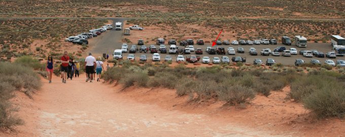
The trail down to the bend in the Colorado River was not as steep as the first section but in spots it was a bit treacherous as there were large flat sandstone rocks that had loose gravel on them. We stepped carefully down and stopped to rest a couple times as it seemed almost as hard going down as up. When we reached the overlook we were in total awe of the site below us. The Colorado River makes a full 270 degree turn from the right side of the picture to the left. We were not brave enough to step to the very edge to take a picture of the water below us. The surface of the river is 1000 feet below the overlook! 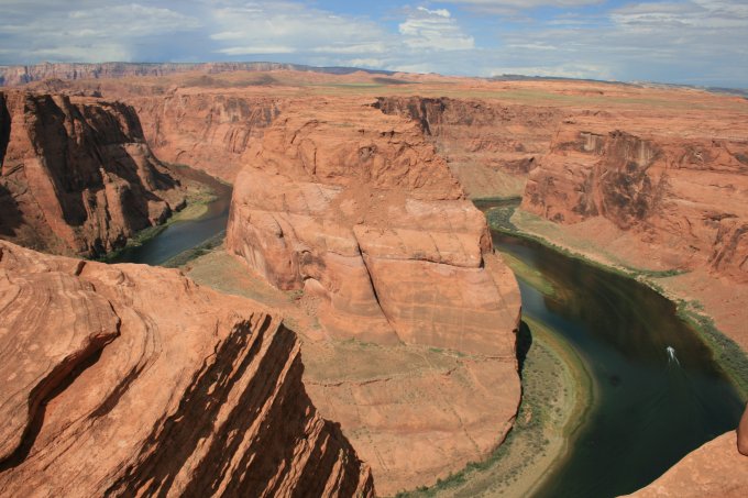
We took our time looking at the bend and all the rocky cliffs and outcroppings. As we turned to start our climb back to the top of the hill we noticed this little lizard sunning himself in a protected area. He is about 8 inches in length and it is a wonder he wasn’t tramped on. 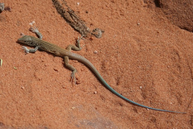
As we stopped to look up at the trail above we started to wonder if we had been wise in making this trek. But there are no rides up or down as well as no provisions for shelter, water, or other comforts. The picture below shows the trail headed up. The red arrow points to the approximate spot where we took the first picture looking down at the parking lot. To the left of it is a shelter, but it is at the top. Luckily we had a nice breeze and the partly cloudy skies helped us from getting too warm. We stopped three times on the way up and although it was a tough climb we were none the worse for wear as we reached the top. 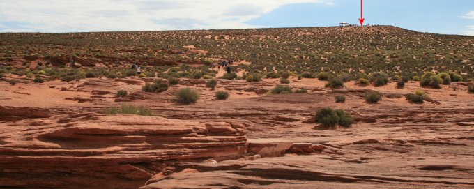
We took a little breather at the top and looked to the northeast at the town of Page. It is near Lake Powell and if you look closely left of center on the horizon you will see a tall stone structure on the horizon that is on the Navajo Nation Reservation, we could not find a reference to any name for the rock formation. 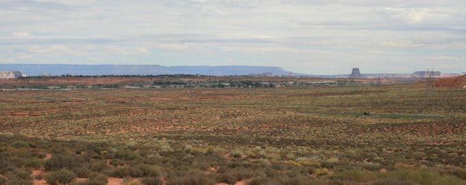
We drove into Page but did not stay as it was very busy with tour busses and other tourists and we really wanted to get to the Grand Canyon as we had been in a couple showers and the sky was very dark over the canyon. If you do not see a menu on the left click here to go to our home page. |